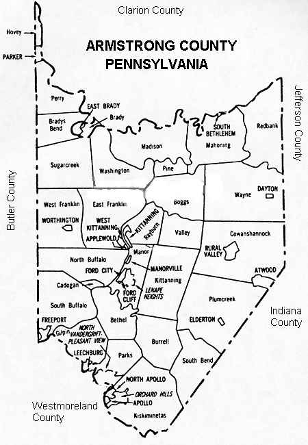
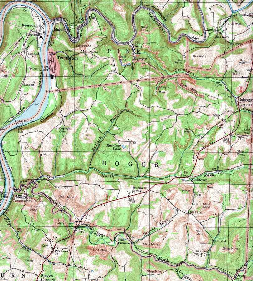
- Boggs, Goheenville, Slabtown
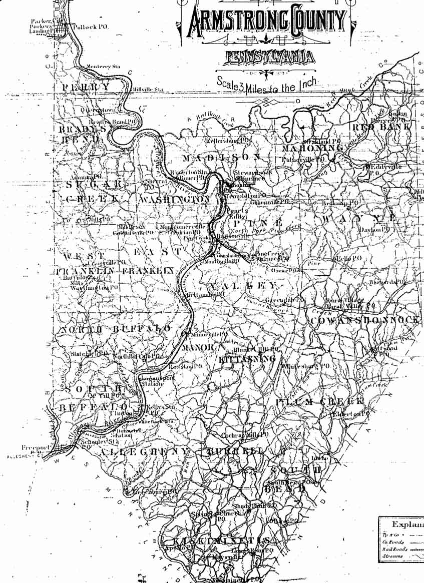
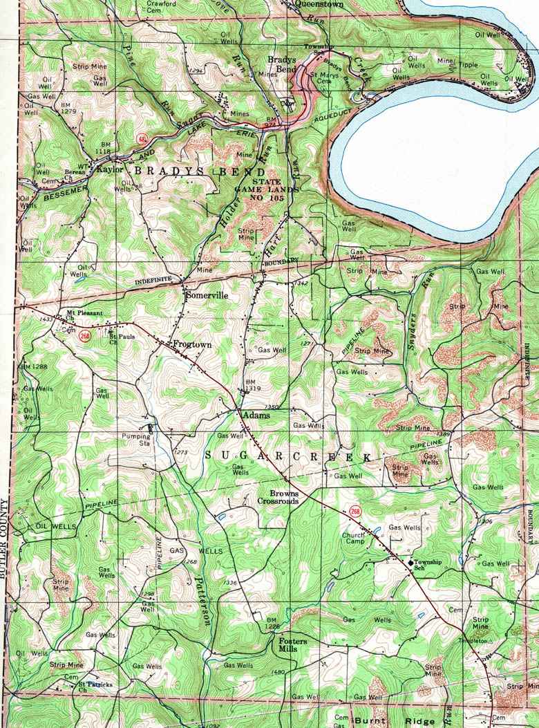
- Bradys Bend, Bradys Bend, Kaylor
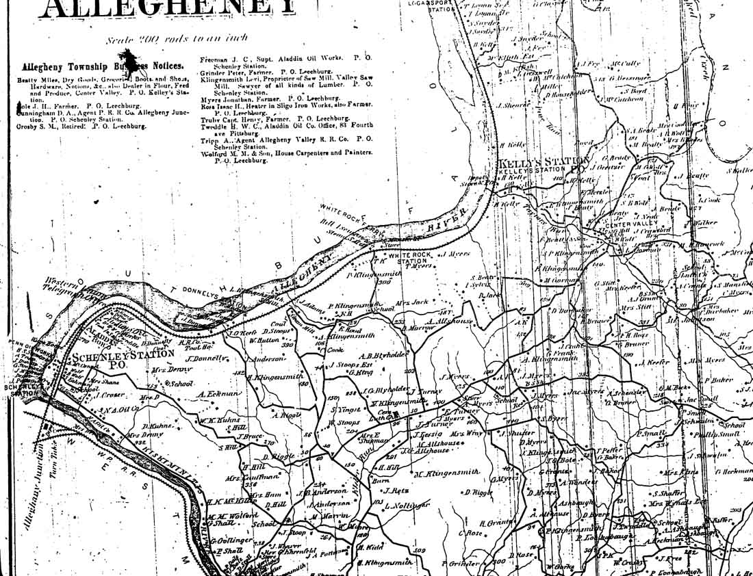
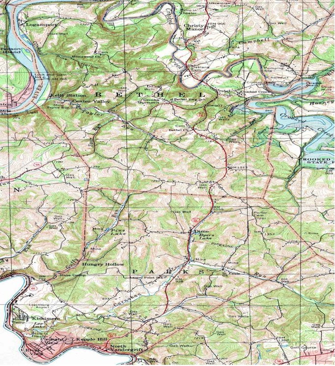
- Bethel, Center Valley, Cooks Summit,
Kelly Station, Logansport
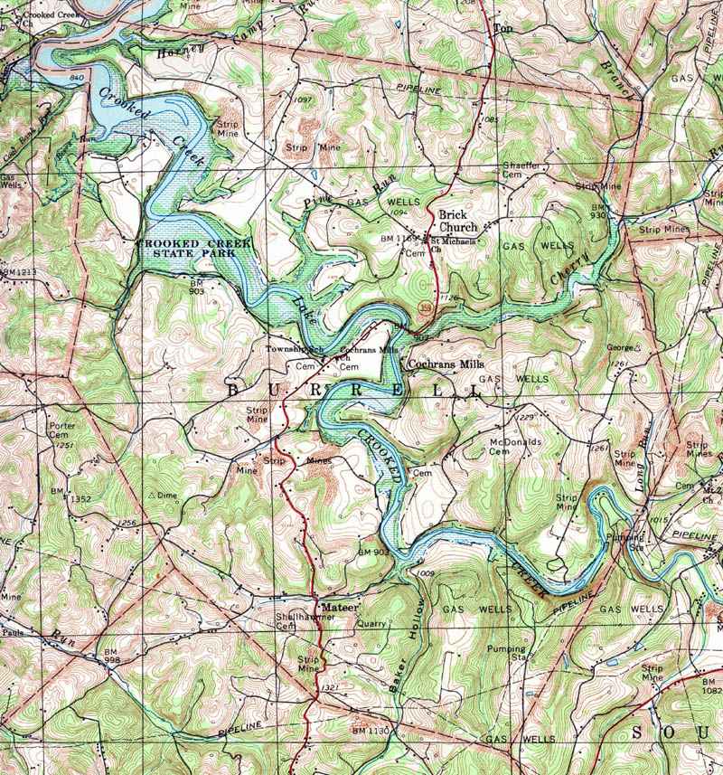
- Burrell, Brick Church, Cochrans Mills,
Crooked Creek, Mateer
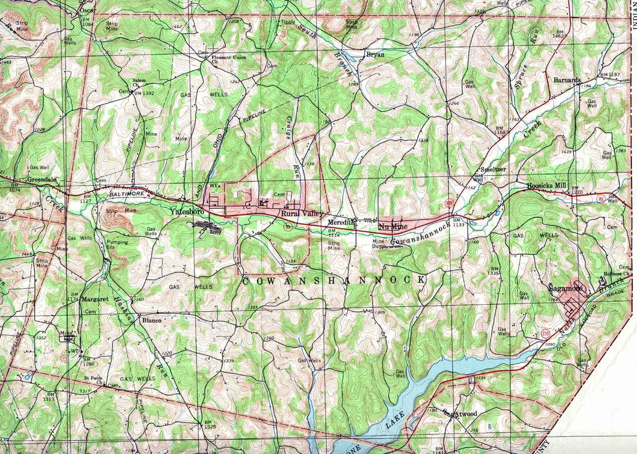
- Cowanshannock, Atwood, Barnards, Bryan,
Hoosicks Mill, Margaret, Meredith, Nu Mine, Rural Valley, Sagamore,
Smeltzer, Yatesboro
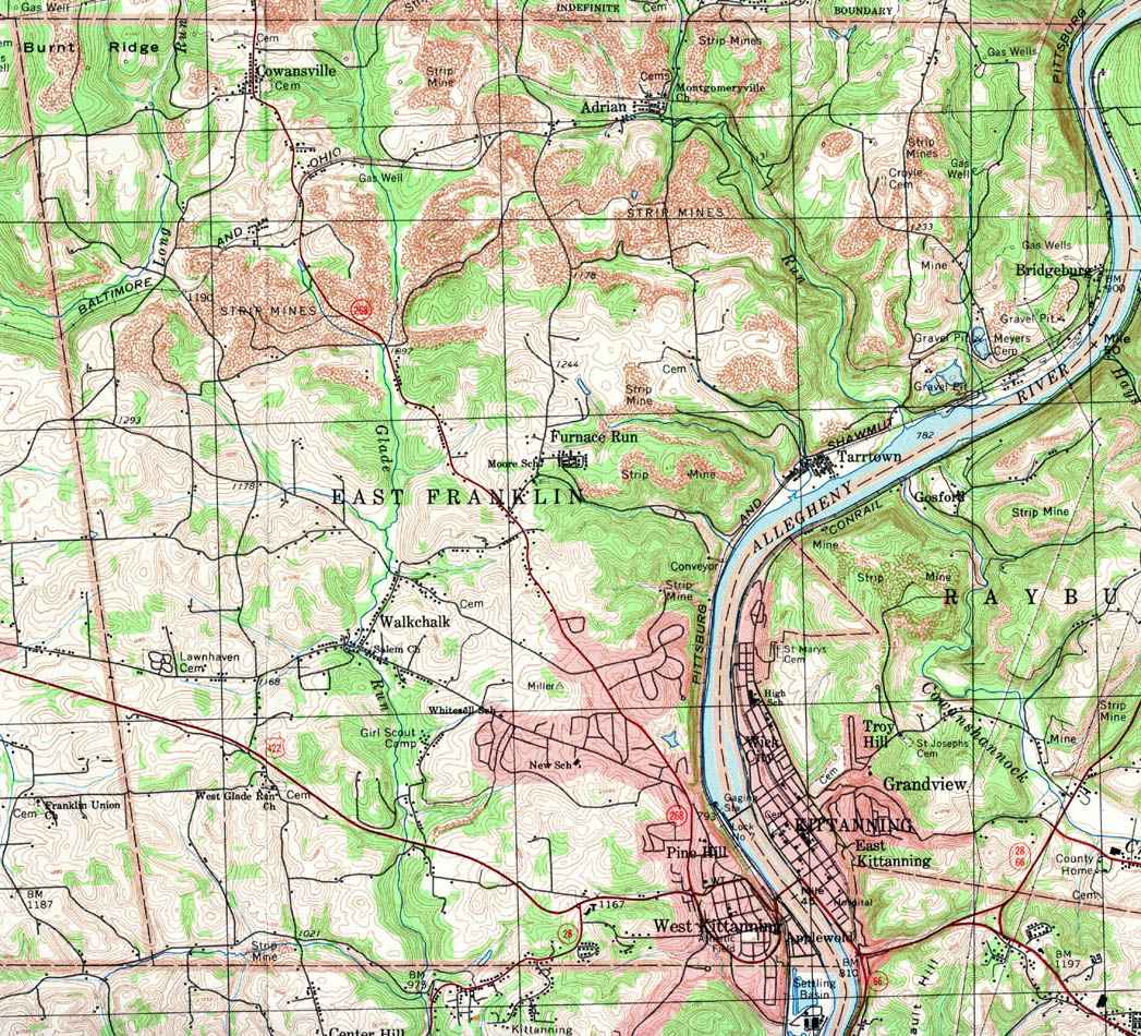
- East Franklin, Adrian, Bridgeburg,
Cowansville, Furnace Run, Kittaning, Pine Hill, Tarrtown, Walkchalk,
West Kittaning
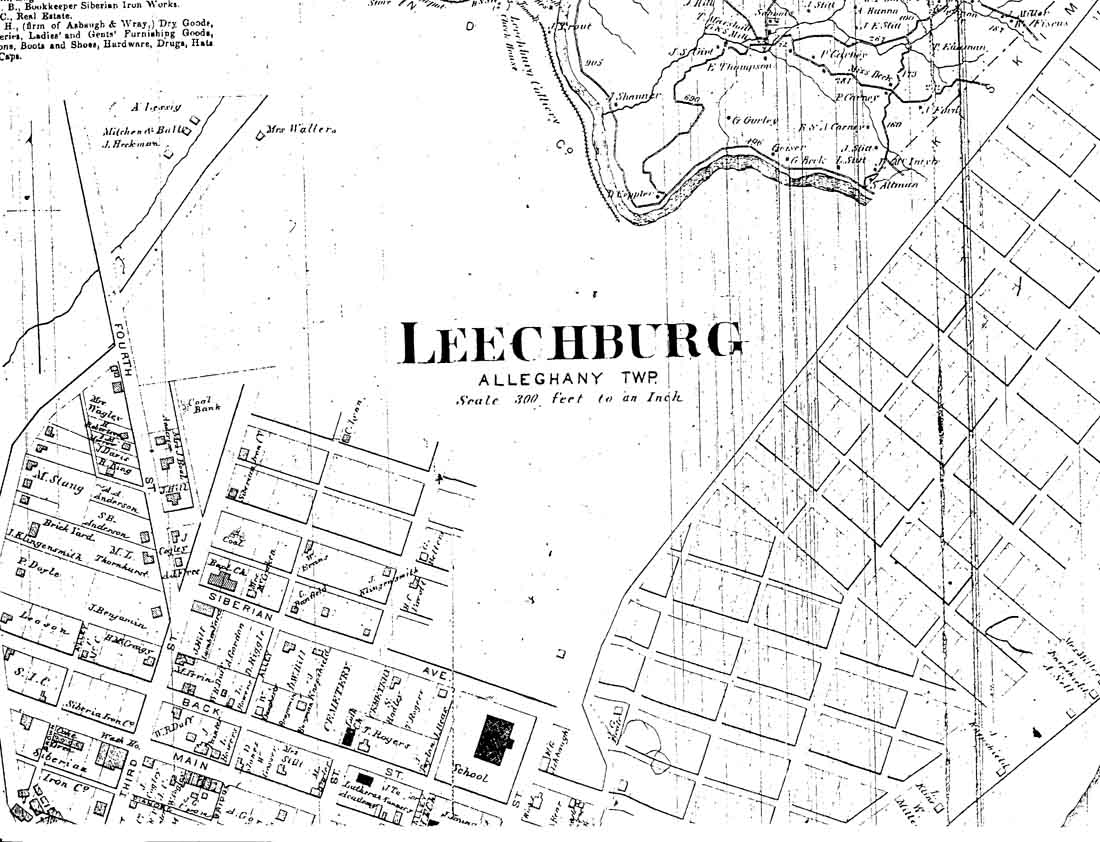
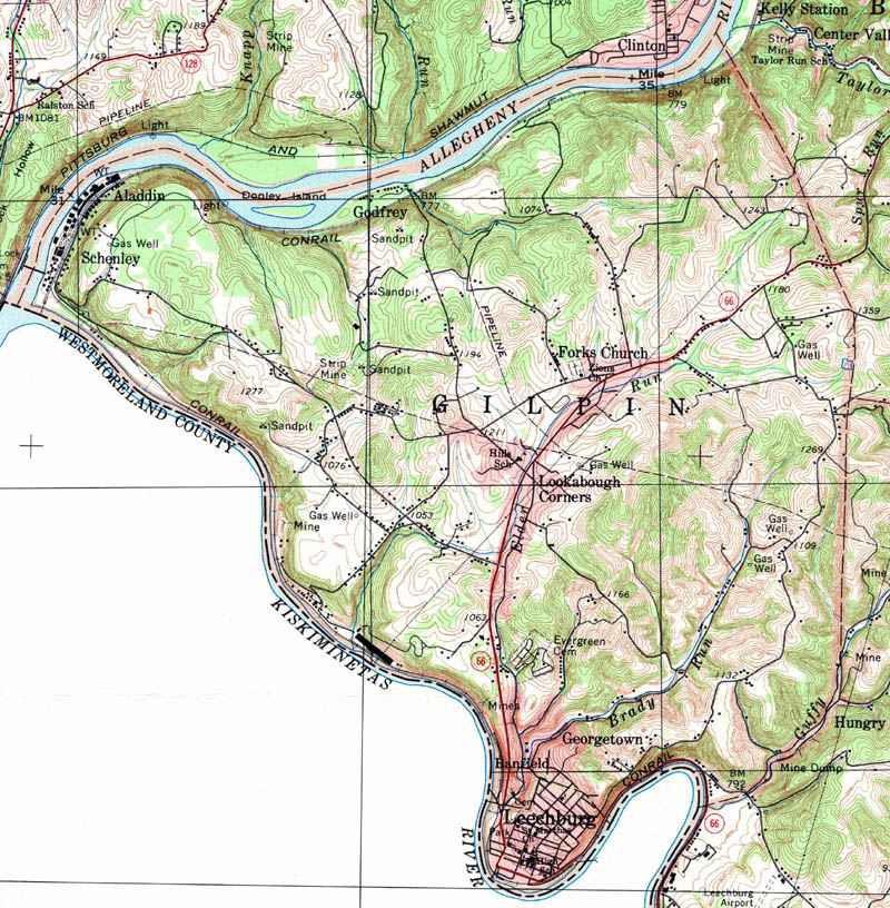
- Gilpin, Aladdin, Banfield, Forks Church,
Georgetown, Godfrey, Leechburg, Lookabough Corners, Schenley
- Hovey
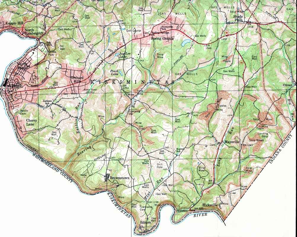
- Kiskiminetas, Apollo, Brownstown, Cherry
Lane, Edmon, Hicksville, Maysville, North Apollo, Orchard Hills, Shady
Plain, Spring Church
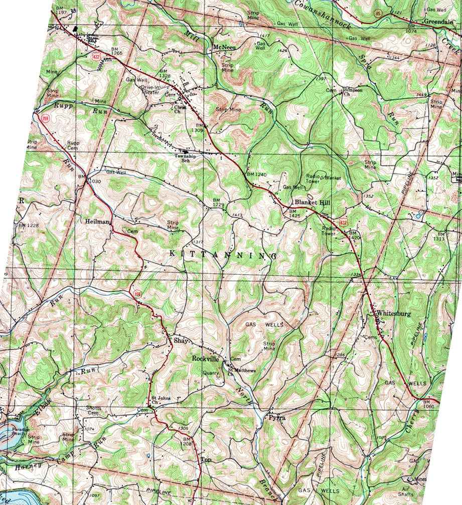
- Kittaning, Blanket Hill, Heilman, McNees
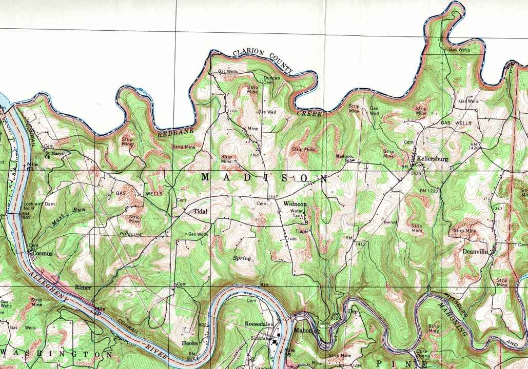
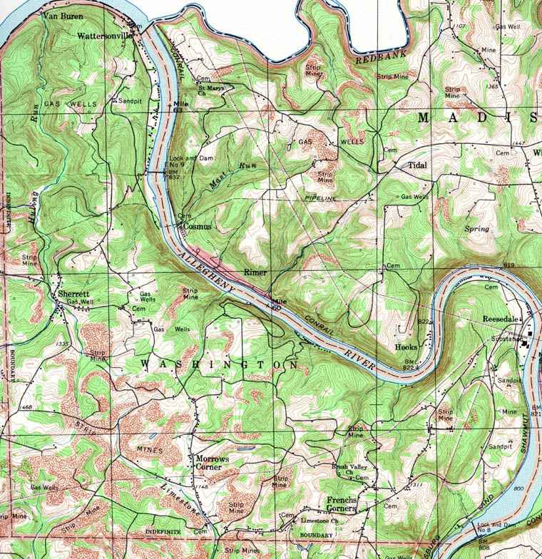
- Madison, Cosmus, Rimer, Hooks, Widnoon,
Kellersburg, Deanville
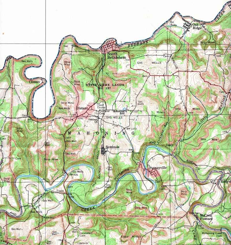
- Mahoning, Climax, Distant, Putneyville,
Seminole, South Bethlehem
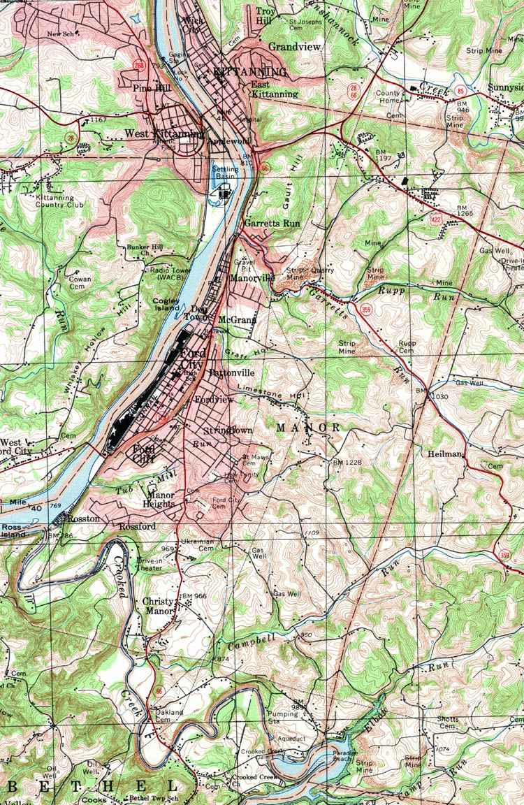
- Manor, Christy Manor, Dog Town, Ford City,
Ford Cliff, Fordview, Garretts Rum, Manor Heights, Manorville, McGrann,
Pattonville, Rossford, Rosston, Stringtown
|
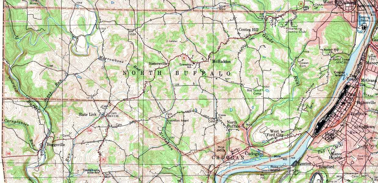
- North Buffalo, Cadogan, Center Hill,
McHaddon, West Ford City, North Buffalo, Sistersville
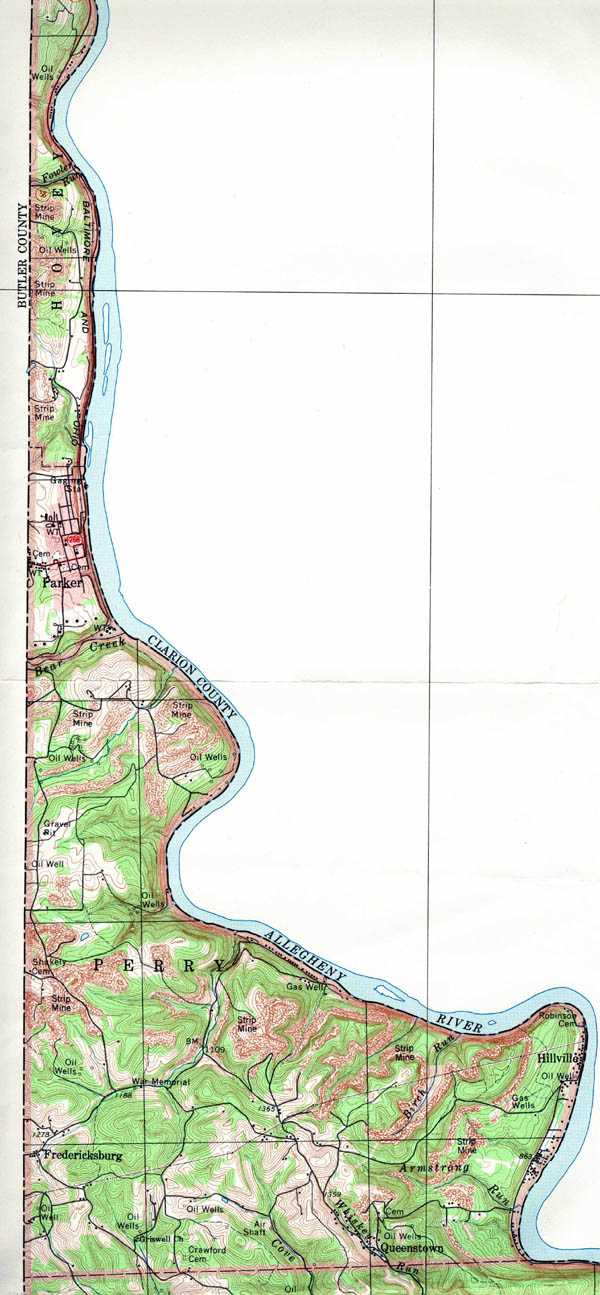
- Parker
- Parks, Dime, Hungry Hollow, Kepple Hill,
Kiskimere, North Vandergrift, Pleasant View, River View
- Perry, Fredericksburg, Hillville,
Queenstown
- Pine, Mahoning, Templeton
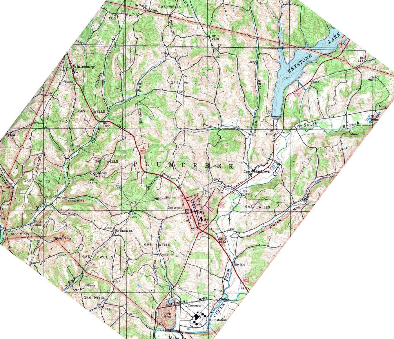
- Plum Creek, Gastown, Elderton, Keystone
Lake, Whitesburg
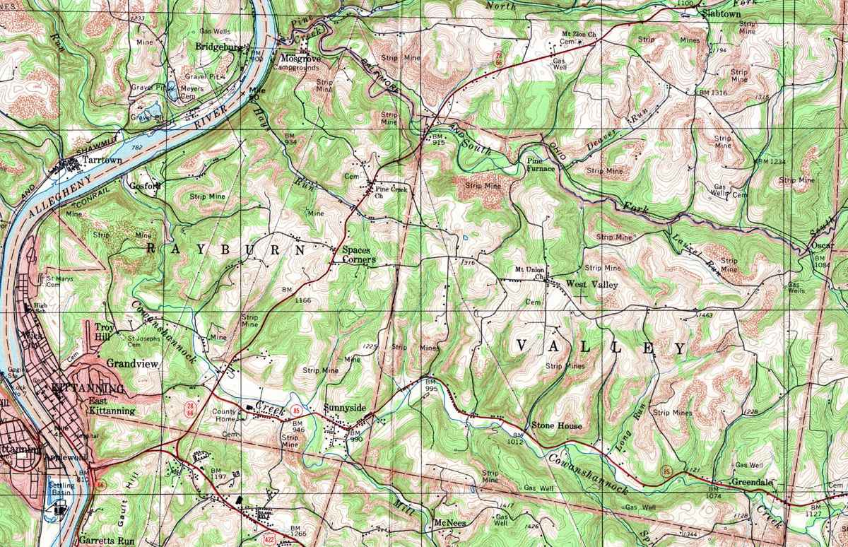
- Rayburn, Gosford, East Kittaning,
Grandview, Kittaning, Mosgrove, Space, Corners, Sunnyside, Troy Hill,
Wick City
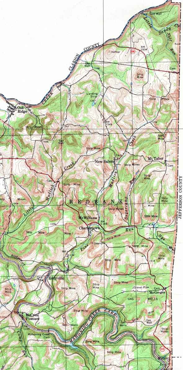
- Redbank, Charlestown, Eddyville, McCrea
Furnace, McGregor, McWilliams, Milton, Mt Tabor, New Salem, Oak Ridge
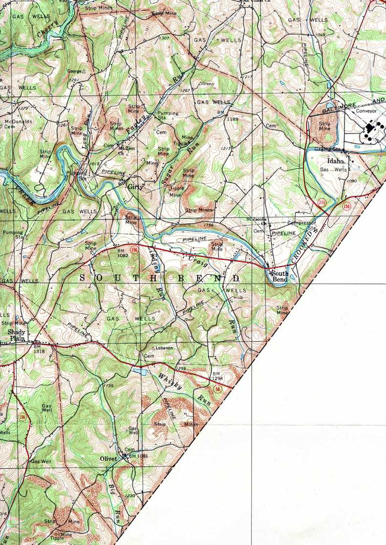
- South Bend, Girty, Idaho, Olivet
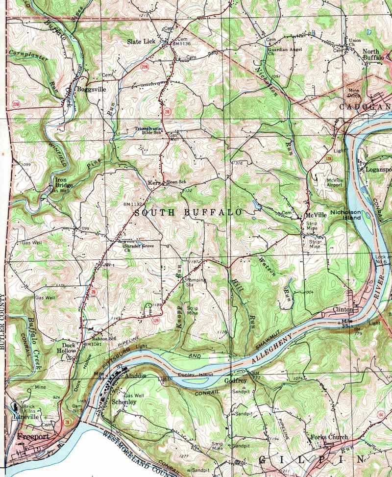
- South Buffalo, Boggsville, Clinton, Dock
Hollow, Freeport, Kerr, Iron Bridge, Laneville, McVille, Slate Lick
- Sugar Creek, Adams, Browns Crossroads,
Fosters Mills, Frogtown, Somerville
- Valley, Greendale, Stone House, West
Valley
- Washington, Frenchs Corners, Morrows
Corners, Reesedale, Sherrett, Van Buren, Wattersonville
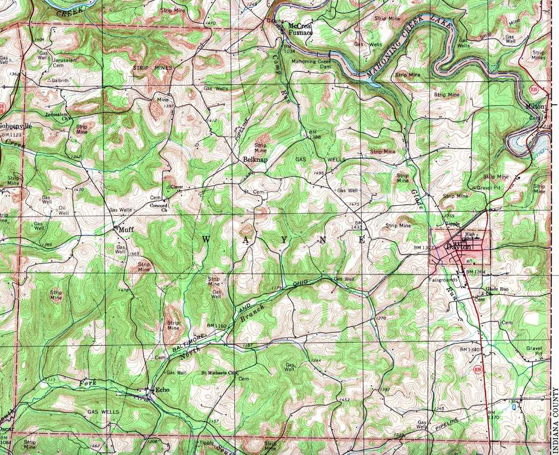
- Wayne, Belknap, Dayton, Echo, Muff
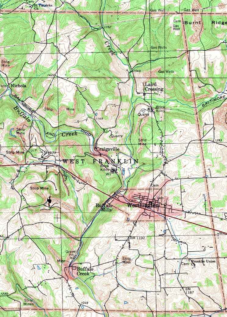
- West Franklin, Buffalo Mills, Buffalo
Creek, Craigsville, Laird Crossing, Nichola, Worthington
|